Grant Supports Work to Curate Data From Premodern Islamic Geographical Manuscripts
March 01, 2024
The innovative digital humanities project will enable historians to better identify geographic locations and place names from medieval documents.
By Jessica Weiss ’05
The University of Maryland has received a nearly $150,000 grant from the National Endowment for the Humanities (NEH) to support efforts to make it easier for historians working with handwritten documents from the premodern Islamicate world—primarily in Arabic, Persian and Turkish—to identify geographic locations and place names.
Assistant Research Professor Osama Eshera of the Roshan Institute for Persian Studies in the School of Languages, Literatures, and Cultures is working with researchers Sajjad Nikfahm-Khubravan and Fateme Savadi, both of McGill University, on the digital humanities project, called “Idrīsī: An Open Library of Historical Geography of the Premodern Islamic World.” Raffaele Viglianti, a research programmer at the Maryland Institute for Technology in the Humanities at UMD, will provide technical support.
Over two years, the researchers will create an open, digital library to store and organize datasets containing historical-geographical data found in hundreds of scientific manuscripts related to topics ranging from astronomy to meteorology and beyond. This is especially important due to the wide variability of place names and geographic locations found in manuscripts from the premodern Islamicate world; a city, village or region might have moved or been identified by different names in different languages, throughout history. One 14th-century manuscript, for instance, offers three sets of geographical coordinates for Rome from three different sources.
Books and manuscripts from this era span over 1,500 years, from the 7th-19th centuries, forming perhaps the largest archive of cultural production of the premodern world.
“We’re talking about a huge corpus of texts and manuscripts that provide a lot of very rich information about geography,” Eshera said. “We’re very grateful to the NEH for supporting us to help make this data available to a broader audience.”
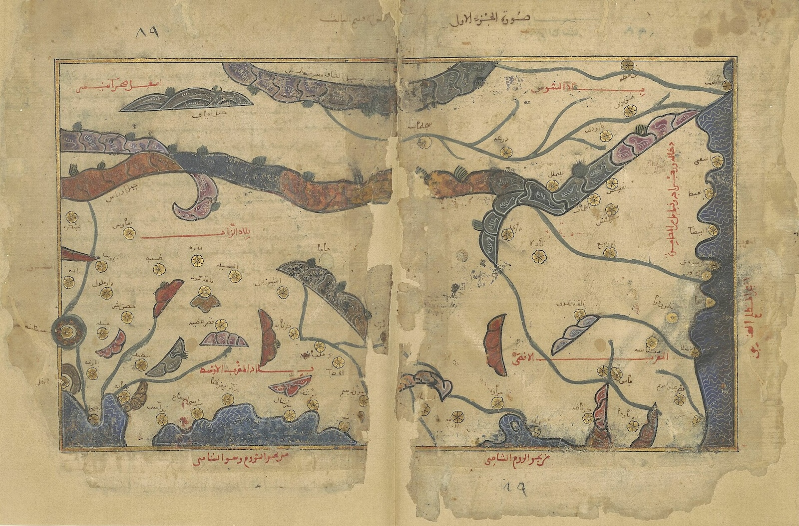
The library’s namesake is al-Sharīf al-Idrīsī (d. 1164–65 or 1175), one of the most well-known geographers of the medieval period and court geographer of Roger II (r. 1112–54) of Sicily. Idrīsī created a widely studied work of mapmaking and geography in Arabic that will serve as the starting point for the NEH project.
The proposal builds on work under development since 2018, known as the “Dabīrān Project on the Intellectual History of the Islamic World,” to facilitate the research of medieval manuscripts from the Islamic world through various avenues—from organizing, reading and digitally transcribing manuscripts; to capturing historical and scientific data from them. The researchers’ work has been published in various peer-reviewed academic outlets.
The Idrīsī Library will ultimately allow researchers to examine how historical works are related to each other, and how geographical information was transmitted from one medieval scholar to the next, Eshera said. For example, researchers will be able to identify where medieval scholars adapted geographical information from their predecessors.
All data compiled during this phase of the project will be published and archived on an open-source basis, ensuring its broad accessibility. The geographical dataset will be shared publicly via the NEH-funded World Historical Gazetteer.
Eshera is also assistant director of the Open Islamicate Texts Initiative’s (OpentITI) Arabic-script OCR Catalyst Project, funded through two grants from The Andrew W. Mellon Foundation and based at UMD under the direction of Assistant Professor of Persian Literature and Digital Humanities Matthew Thomas Miller.
Image: One of the 70 maps by al-Sharīf al-Idrīsī (d. 1164–65 or 1175): preserved in MS Paris, Bibliothèque nationale de France, Arabe 2221 (fols 89b–90a). The image shows a map which contains the west-most regions of North Africa, with the North-African coastline of the Mediterranean.